Kwania district suspends wetland demarcation exercise

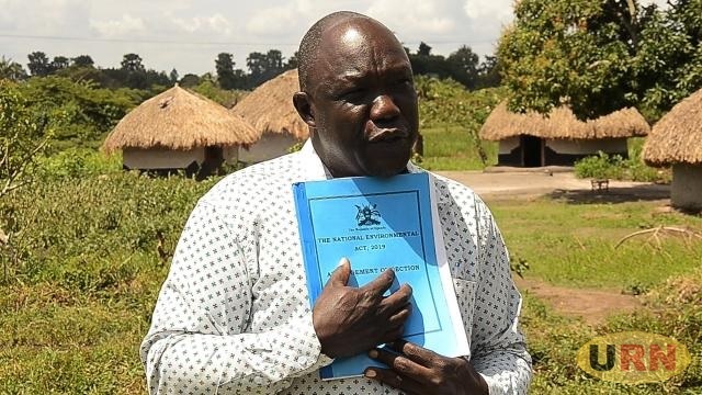
Kwania, Uganda | THE INDEPENDENT | Kwania district leaders have suspended the demarcation of wetland boundaries in the district.
The suspension comes just months after the Ministry of Water and Environment launched a boundary demarcation project along the shores of Lake Kwania. This initiative was part of a cabinet resolution aimed at protecting wetlands from encroachment.
Kwania district LC V Chairman Geoffrey Alex Ogwal Adyebo announced the suspension on Thursday, November 14, 2024, while addressing stakeholders at the 2024/25 Budget Conference held at the West Lango Diocesan headquarters.
Ogwal explained that the suspension was prompted by concerns over flooding, which has submerged large areas of land, particularly along the shores of Lake Kwania. He said the suspension, which takes immediate effect, would remain until the flooding situation normalizes, directing the district’s Natural Resource department to comply with the directive.
Jimmy Okweny, Kwania District Senior Environment Officer, noted that by the time of the suspension, 220 kilometers of buffer zones had already been demarcated along the 100-kilometer stretch of Lake Kwania’s shoreline. The district had received 330 concrete pillars from the Ministry, but Okweny explained that flooding had overtaken much of the land, warning affected residents not to settle in the buffer zones. He encouraged them to engage in regulated activities like fish farming.
Residents affected by the floods along the shores of Lake Kwania have welcomed the district leaders’ decision to suspend the boundary demarcation process. Jimmy Emmanuel Okello Ecun, a resident of Atuma village, Acaba Parish in Nambieso Sub County, expressed relief, noting that his 13 acres of land had already been submerged by the floods. He is optimistic that the suspension will prevent further loss of land due to the demarcation exercise.
However, Zumbe Adyeri, the LCIII Chairman of Abongomola Sub County, called on district leaders to find a long-term solution to the recurrent flooding, which has affected the largest population in the district. He pointed out that wetlands were being degraded by people seeking land for rice farming, and urged leaders to support rice production rather than depriving farmers of land.
David Wasike Wamburu, the Kwania Chief Administrative Officer, highlighted the ongoing issue of wetland encroachment in the district. He directed the Natural Resource Department to ensure that their budget allocation supports the demarcation of wetland boundaries and strengthens community sensitization programs to raise awareness about the importance of these ecosystems.
According to data from the Ministry of Water and Environment, approximately 9,460 hectares of wetland in Kwania have been encroached upon for various activities. Out of an estimated 30,120 hectares of wetlands in the district, only 20,660 hectares remain intact. The report also names Akali, Abongomola, Aduku, Nambieso, Inomo, and Ayabi Sub Counties as areas with rampant wetland encroachment.


